
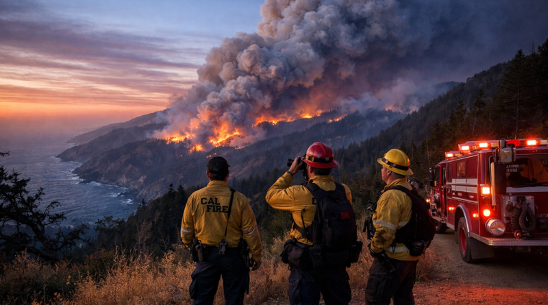
Big Sur Wildfire Emergency: Timber Fire Tops 23,000 Acres as Plaskett Fire Threatens California Coast
California Local News | Big Sur, Monterey County | August 28, 2026
By NewYorkFinanceThink California Local News Desk
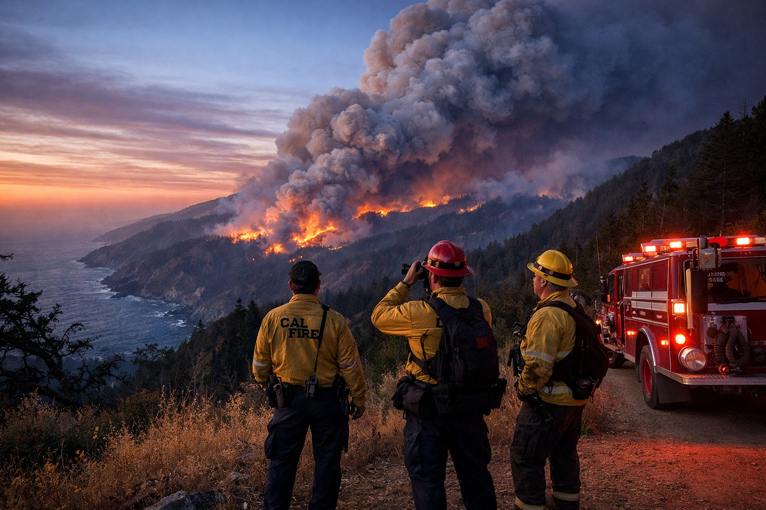
BIG SUR, Calif. — Smoke hanging over the mountains, emergency crews moving along the Highway 1 corridor and evacuation restrictions across parts of Monterey County have turned one of California’s most scenic coastal regions into an active wildfire emergency.
The Timber Fire has burned 23,365 acres and was 21% contained, according to the latest CAL FIRE incident information available August 28. The fire began August 8 southeast of Loma Vista and remains under investigation.
A second fire is adding pressure to the response.
The Plaskett Fire has burned 2,774 acres and remains 0% contained, according to CAL FIRE. It started August 26 in the Plaskett area east of Los Burros Road.
For people who live and work along the Big Sur coast, the emergency is about more than acreage.
It is about whether roads remain open, whether evacuation routes are available, whether firefighters can reach threatened homes and how quickly weather conditions can change.
The response involves CAL FIRE, the U.S. Forest Service, Monterey County Sheriff’s Office, California Highway Patrol and other cooperating agencies.
Big Sur Fire Update: Two Fires, One Difficult Coastline
The Timber Fire is the larger of the two incidents.
Its footprint has expanded across more than 23,000 acres, while firefighters continue working to strengthen containment lines and protect structures and infrastructure.
The Plaskett Fire is much smaller by acreage but presents its own challenge.
The fire is burning through steep and rugged terrain where access for ground crews can be difficult. CAL FIRE reports that helicopters, aircraft, heavy equipment and ground resources are being used as conditions allow.
That combination makes the Big Sur situation different from a wildfire burning across open, easily accessible land.
Firefighters have to consider terrain, wind, road access, aircraft availability and the location of homes and businesses at the same time.
Timber Fire Has Reached 23,365 Acres
The latest official Timber Fire figure is 23,365 acres.
Containment stands at approximately 21%.
That number should be read carefully.
Twenty-one percent containment does not mean 21% of the burned area has been extinguished.
Containment refers to the portion of the fire perimeter where firefighters have established control lines intended to stop or slow the fire.
The remaining perimeter can continue to burn even when containment increases.
CAL FIRE reports that crews have been conducting containment work and tactical firing operations in portions of the Timber Fire area.
In some areas, firefighters are deliberately burning vegetation between the main fire and containment lines.
The objective is to remove fuel before the wildfire reaches it.
Plaskett Fire Remains at 0% Containment
The newer Plaskett Fire has become a major concern because of its location and rapid development.
CAL FIRE’s latest incident information lists the fire at 2,774 acres with 0% containment.
The fire began on August 26.
That means firefighters are still working to establish a reliable perimeter and control the fire’s movement.
The rugged landscape makes the job harder.
Some portions of the fire can be difficult or dangerous to reach by vehicle, increasing the importance of aircraft and specialized ground crews.
Evacuation Orders Put Public Safety First
Evacuation orders remain one of the most important parts of the Big Sur emergency.
CAL FIRE distinguishes between an evacuation order and an evacuation warning.
An evacuation order means an immediate threat to life and requires people in the affected area to leave.
An evacuation warning means a threat may be developing and residents should prepare to leave, particularly people who need extra time because of pets, livestock, children or mobility issues.
The exact evacuation zones can change as fire conditions develop.
That is why residents should check the latest official Monterey County and CAL FIRE information rather than relying on an old map or social-media post.
Highway 1 Closure Creates a Second Emergency
The wildfire has also disrupted one of California’s most famous highways.
The latest CAL FIRE information lists a major Highway 1 closure between Mile Marker 10.1 near Gorda and Mile Marker 56 south of the Little Sur River.
For tourists, that means a scenic drive is no longer possible through the affected section.
For residents, the consequences are much more serious.
Highway 1 is a working transportation corridor.
People use it to reach homes, jobs, businesses and services.
Emergency vehicles also depend on the road.
Keeping civilian traffic away from the active fire zone gives emergency crews more room to operate.
Why Highway 1 Had to Be Closed
A wildfire can create hazards far beyond flames.
Drivers entering an active fire area may encounter:
- Heavy smoke
- Falling trees
- Fire engines
- Emergency personnel
- Poor visibility
- Ash and debris
- Utility hazards
- Sudden spot fires
- Changing road conditions
A road that appears safe from a distance can become dangerous quickly.
For that reason, motorists should never attempt to bypass barricades or official closures.
Monterey County Sheriff’s Office Supports Evacuation Operations
The wildfire response is not being handled by firefighters alone.
The Monterey County Sheriff’s Office has an important public-safety role, particularly in evacuation and access-control operations.
When evacuation orders are issued, law enforcement personnel may help move residents away from threatened areas and prevent people from entering closed zones.
That work becomes particularly important on narrow roads where emergency vehicles and civilian traffic could otherwise compete for limited space.
The Sheriff’s Office works alongside fire agencies and other emergency organizations during the incident.
California Highway Patrol Helps Keep the Corridor Clear
The California Highway Patrol also plays an important role when Highway 1 and surrounding roads are affected by wildfire.
Traffic control may be necessary to keep evacuation routes moving and ensure emergency equipment can reach the fire area.
During a large wildfire, a highway can quickly become part of the emergency operation itself.
It is not simply a route for motorists.
It can become a staging and access corridor for firefighters, ambulances, law enforcement officers and heavy equipment.
Aircraft Give Firefighters Another Option
Big Sur’s terrain makes aircraft especially valuable.
Helicopters can reach areas that may be difficult for ground crews to access directly.
Aircraft can also support structure defense and suppression operations when weather conditions allow.
The Plaskett Fire incident response includes helicopter and aerial resources, according to CAL FIRE.
But aircraft have limitations.
Smoke, clouds, strong winds and poor visibility can restrict operations.
That means aerial resources cannot always be used simply because a wildfire is active.
The Terrain Is One of the Biggest Challenges
Big Sur’s landscape is beautiful, but it is unforgiving for emergency operations.
The region contains steep slopes, ridges, canyons and remote areas.
Road access is limited in many locations.
A firefighter cannot simply drive a fire engine to every portion of the perimeter.
Crews may have to approach on foot, work from roads or ridgelines, or establish lines in difficult terrain.
The Plaskett Fire’s rugged terrain is specifically identified as an operational challenge in official incident information.
Weather Could Change the Situation Quickly
Weather is another major factor.
Thunderstorms can produce lightning, while outflow winds can change direction quickly.
For firefighters, changing wind is one of the most important hazards because it can alter the direction and speed of fire spread.
A fire that appears relatively stable can behave very differently when wind conditions change.
That is why incident commanders continuously reassess fire behavior and weather.
Dry Lightning Raises Concern for New Ignitions
Dry lightning is particularly concerning in wildfire country.
Lightning can ignite vegetation in remote areas.
If little rain reaches the ground, the lightning can create a new fire without providing enough moisture to significantly reduce fire danger.
Strong thunderstorm outflows can then push those fires rapidly.
For communities near the Big Sur coast, this creates an additional layer of uncertainty during an already active emergency.
Big Sur Wildfire Data Table
| Indicator | Latest Reported Figure | Significance |
|---|---|---|
| Timber Fire | 23,365 acres | Primary large wildfire |
| Timber Containment | 21% | Partial perimeter control |
| Timber Start Date | August 8, 2026 | Long-running incident |
| Plaskett Fire | 2,774 acres | Second major wildfire |
| Plaskett Containment | 0% | Active suppression challenge |
| Plaskett Start Date | August 26, 2026 | Rapidly developing incident |
| Area | Big Sur, Monterey County | Rugged Central Coast |
| Highway 1 | Major closure | Transportation disruption |
| Evacuation Orders | Multiple zones | Immediate life-safety restrictions |
| Law Enforcement | Monterey County Sheriff’s Office | Evacuation/public safety |
| Highway Safety | California Highway Patrol | Traffic and closure support |
| Fire Agencies | CAL FIRE / U.S. Forest Service / cooperating agencies | Multi-agency response |
| Air Resources | Helicopters and aircraft | Suppression and structure defense |
| Fire Causes | Under investigation | No confirmed cause reported |
| Main Challenges | Terrain, wind, smoke and access | Complicate suppression |
Source: Latest available CAL FIRE Timber Fire and Plaskett Fire incident information, August 28, 2026.
Ground-Level Case Study: How a Big Sur Wildfire Becomes a Regional Emergency
The Big Sur fires provide a useful case study in modern California wildfire response.
Imagine the emergency from the perspective of a resident living near the Highway 1 corridor.
The first concern is not the acreage number appearing on a website.
It is the evacuation zone.
Is the home inside an order?
Is the road still open?
Can the family leave safely?
Where are pets going?
Is the nearest route available?
Those questions quickly connect the wildfire to law enforcement, transportation authorities and emergency managers.
At the same time, firefighters are looking at an entirely different set of questions.
Where is the fire moving?
Where can a containment line be constructed?
Can crews safely reach the ridge?
Is aircraft support available?
Will the wind change?
Can homes along the road be protected?
This is why a wildfire becomes a multi-agency emergency.
Case Study Point 1: Fire Size Is Only One Measurement
A 23,365-acre fire sounds enormous.
It is.
But acreage alone does not determine immediate danger.
A smaller fire can threaten homes more directly than a much larger fire burning in remote wilderness.
Fire officials therefore consider several factors together:
- Fire location
- Rate of spread
- Wind
- Terrain
- Fuel
- Structures
- Evacuation routes
- Firefighter access
- Weather forecast
For readers, this means a headline should not focus only on acres.
Case Study Point 2: Containment Can Be Misunderstood
The Timber Fire’s 21% containment figure is useful, but it does not mean the danger has disappeared.
Containment lines can be strengthened.
They can also be challenged by wind, embers or changing fire behavior.
That is why firefighters continue working even after a fire reaches partial containment.
Case Study Point 3: A Second Fire Changes the Resource Picture
The Plaskett Fire adds another layer.
Fire agencies must manage personnel, aircraft and equipment across multiple active incidents.
That does not necessarily mean resources are unavailable.
California and federal agencies can bring in additional crews and equipment.
But multiple incidents require careful coordination.
The Big Sur emergency demonstrates why incident management teams are important during complex wildfire operations.
Case Study Point 4: Law Enforcement Is Part of Fire Response
A wildfire cannot be managed safely if evacuation roads are blocked.
That makes law enforcement a critical part of the response.
Sheriff’s deputies and highway officers help maintain access, move traffic and keep civilians out of restricted areas.
Their work happens alongside firefighters rather than separately from them.
Case Study Point 5: Local Businesses Feel the Impact
Big Sur’s economy is closely connected to tourism.
A Highway 1 closure can mean fewer visitors.
Hotels can lose reservations.
Restaurants can lose customers.
Employees can have difficulty reaching workplaces.
Suppliers can face access problems.
These economic effects can continue after the fire is contained.
The reopening of a road does not necessarily mean that local businesses immediately return to normal.
Case Study Point 6: Public Information Becomes a Safety Tool
During a fast-moving emergency, information itself becomes part of public safety.
Residents need to know:
Where is the fire?
Which zones are under evacuation orders?
Which roads are closed?
Where can residents obtain official updates?
What has changed since the previous update?
That is why local news organizations should timestamp wildfire stories and clearly identify their sources.
What California Residents Should Do
Residents near an active wildfire should keep their emergency plans ready.
If an evacuation order is issued, follow it.
Do not wait until smoke becomes heavy or flames become visible.
People who need additional time to leave should prepare early.
That includes residents with:
- Pets
- Livestock
- Young children
- Elderly family members
- Mobility limitations
- Medical or other essential needs
Important items should be ready before an emergency becomes urgent.
What Visitors Should Know
Visitors should not enter closed portions of Big Sur.
Do not drive around barricades.
Do not follow unofficial directions that suggest an alternative route through a closed area.
Wildfire conditions can change rapidly, and emergency personnel may close additional roads with little notice.
Anyone planning a trip should check current official road and fire information before leaving.
Why NewYorkFinanceThink Is Covering This as California Local News
Although NewYorkFinanceThink.com covers finance and the economy, major California emergencies can have direct economic consequences.
Wildfires affect:
- Transportation
- Tourism
- Small businesses
- Employment
- Insurance
- Property
- Infrastructure
- Local government spending
- Regional supply chains
That makes wildfire coverage relevant to both local readers and readers interested in California’s broader economy.
A road closure along the Big Sur coast is therefore more than a travel inconvenience.
It can become a local economic story.
Frequently Asked Questions
What is the latest Timber Fire acreage?
The latest CAL FIRE incident information available August 28 lists the Timber Fire at 23,365 acres.
How much of the Timber Fire is contained?

The latest reported containment is approximately 21%.
How large is the Plaskett Fire?
CAL FIRE lists the Plaskett Fire at 2,774 acres.
Is the Plaskett Fire contained?
The latest official figure is 0% containment.
Are evacuation orders active?
Yes. Multiple evacuation orders are associated with the affected fire areas. Residents should check current official zone information because orders can change.
Is Highway 1 closed?
Yes. A major section of Highway 1 remains closed in the affected Big Sur corridor.
Which agencies are responding?
The response includes CAL FIRE, the U.S. Forest Service, Monterey County Sheriff’s Office, California Highway Patrol and other cooperating agencies.
Are helicopters being used?
Yes. Aircraft and helicopters are supporting suppression and structure-defense operations where weather and operational conditions allow.
Why is Big Sur difficult to fight a wildfire in?
The region’s steep, rugged terrain and limited road access make it difficult for ground crews and heavy equipment to reach some areas.
Are the fire causes known?
The causes remain under investigation according to current official incident information.
Can evacuation zones change?
Yes. Evacuation orders and warnings can be expanded, reduced or modified as fire conditions change.
When will Highway 1 reopen?
There is no reliable reopening time until the responsible authorities determine that the road is safe and operational needs allow reopening.
Final Ground Report
The Big Sur wildfire emergency is a reminder that California wildfire stories cannot be measured by acreage alone.
The Timber Fire has reached 23,365 acres, while the Plaskett Fire has reached 2,774 acres and remains at 0% containment, according to the latest CAL FIRE incident information.
Behind those numbers are firefighters working in steep terrain, law-enforcement officers managing evacuation operations, highway personnel controlling access and residents making difficult decisions about when to leave.
Highway 1 remains an important part of the story because the road connects communities, businesses and emergency operations along the coast.
Weather adds another layer of uncertainty.
Wind can change.
Thunderstorms can develop.
Smoke can reduce visibility.
Fire behavior can shift.
For residents, the safest approach is to treat official evacuation orders and emergency alerts as the highest priority.
For visitors, the safest approach is to stay away from closed areas.
For California readers following the emergency from outside Monterey County, the Big Sur fires offer a clear picture of how quickly a wildfire can become a regional public-safety and economic event.
The situation remains active and conditions can change rapidly. Readers should verify the latest evacuation, fire and road information with official authorities before traveling or making emergency decisions.
Official Information
CAL FIRE — Timber Fire: Official incident information and operational updates.
CAL FIRE — Plaskett Fire: Official fire size, containment, evacuation and response information.
Monterey County: Local emergency and evacuation information.
Monterey County Sheriff’s Office: Law-enforcement and public-safety information.
California Highway Patrol: Highway closure and traffic information.
U.S. Forest Service: Federal wildfire and Los Padres National Forest information.
This article is a news report based on information available August 28, 2026. Fire acreage, containment, evacuation zones and road closures may change after publication. Official emergency instructions take precedence over this report.